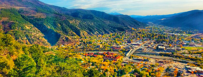
Discover Glenwood Springs your way with a new 3-D map that makes it easy to find all the best places to play, stay, and eat in Colorado’s favorite hot springs town.
Explore Glenwood Springs with ease using an interactive map platform created by Wander for Visit Glenwood Springs. Locate hotels near the activities you have planned, find restaurants within walking distance, and discover the town’s most popular itineraries including hot springs, traveling with pets, rainy day activities with more to come.
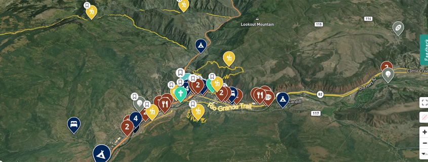
The Wander map is a new mobile-friendly platform and an ideal companion on your next visit to Glenwood Springs. With it, you can discover, plan, and explore with a customized 3-dimensional map on your smartphone, PC or tablet. Use it to create lists of must-do activities, pin notable locations, and plan the details of your trip to maximize your vacation time.
Why Use the Wander Map?
Wander, but don’t get lost.
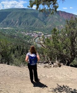 Familiarize yourself with Glenwood Springs by using the town’s interactive map. With the platform, you can quickly and easily get an overview of the area, even before arriving—locate major attractions, find restaurants, local parks and area trailheads effortlessly plan your adventures. Having all this information at your fingertips is a time saver, allowing you to skip the hassles and focus on the fun.
A top highlight of the Glenwood Springs Wander is its filtering capability. A feature that allows you to focus on what interests you and block out the rest. For example, if you’re searching for a restaurant, eliminate the distracting and unnecessary information about lodging or activities.
You can also search for specific locations. Want to know more about Hanging Lake? Enter it into the app and learn where to purchase permits and other important, up-to-date details about hiking this popular trail in Glenwood Canyon.
No service? No problem. The Wander map has some great offline features as well. It’s GPS enabled, allowing you to track your location even without a connection; and, as long as you have the map downloaded, it will be 100-percent available even offline.
Wandering in Glenwood Springs
 Get started by downloading Wander from your phone’s app store and scanning the QR code here. If you are not a fan of downloading another app, you can access Glenwood Springs’ Wander map on VisitGlenwood.com. It’s easy to access suggested itinerary lists, accommodations, activities and attractions, dining options, and information about trailheads, parks and transportation.
The best part, however, is the Wander app’s ability to create and save custom itineraries or lists specific to your Glenwood Springs trip. The places you stay, eat, and recreate will vary depending on whether you’re planning a romantic weekend getaway for two or a week-long summer vacation for the whole family.
Park the Car & Wander on Foot
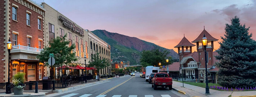
 With lodging, restaurants, and attractions all close to downtown, Glenwood Springs is a foot-friendly town. Walking and biking primarily, and even taking the free local bus, are great options to get around town, eliminating the need for driving or finding parking. The connectivity that comes with downtown’s sidewalks, miles of riverside paved trails, and strategic bridges that span the waterways make it easy to navigate on foot or by bike.
When you use Glenwood’s interactive map, you can also see bus stops in relation to your location with a single glance at your phone. Ride Glenwood Springs, the town’s free public transit bus service, operates daily from 7 a.m. to 7:30 p.m. at 30-minute intervals, with stops conveniently close to attractions, points of interest, hotels, and shopping areas.
Wander to Glenwood Springs
What are you waiting for? Experience more! Checkout the new Wander map and start making plans to visit Glenwood Springs today.