Skip to content
  • HANGING LAKE RESERVATIONS
  • CONTACT US
  • HANGING LAKE RESERVATIONS
  • CONTACT US
Visit Glenwood Logo
Main Menu
  • Stay
  • Play
  • Eat
  • Hanging Lake
  • History
  • Blog
  • About
    • Area Info
    • Events
    • Media
    • Groups & Weddings
Main Menu
  • Stay
  • Play
  • Eat
  • Hanging Lake
  • History
  • Blog
  • About
    • Area Info
    • Events
    • Media
    • Groups & Weddings

Motorcycle Loop Ride That Begins in Glenwood Springs Hits Colorado’s High Points

Home / Trip Ideas / Motorcycle Loop Ride That Begins in Glenwood Springs Hits Colorado’s High Points

From Glenwood Springs, head out on the highway for one of the most scenic rides in Western Colorado. Glenwood Springs, best known for its hot springs, river sports and mountain-top amusement park, is the starting point for a 190-mile excursion that takes riders through some the state’s most breathtaking scenery with ample opportunities for roadside stops along the way.

This high elevation loop ride is possible only when Independence Pass is open, from late spring through late fall. Before heading out, fuel up with gas and a hearty breakfast in Glenwood Springs then hit the road for the ride of a lifetime. Once back in Glenwood Springs; after nearly 200 miles (321.9 km) of riding the open road, relax with a good meal at one of Glenwood’s many restaurants and a soak or a steam at Iron Mountain Hot Springs, Glenwood Hot Springs or the Yampah Vapor Caves.

POINT TO POINT ACCESS

Glenwood Springs to Aspen

(40 miles/64.4 km) From Glenwood, point your bike toward Aspen along Highway 82. Near Carbondale you’ll notice majestic Mt. Sopris. Topping out at 12,966-ft (3,952-m), Sopris is a popular peak to climb in the summer and fall. On the ride south, you’ll pass by Buttermilk Mountain where ESPN’s X Games are held every January. In Aspen, Highway 82 becomes Main Street. Stop for a quick stroll along the resort town’s outdoor pedestrian mall.

Aspen to Independence Pass

(20 miles/32.2 km)) The pass features many stop-worthy attractions including scenic overlooks and wildlife viewing areas. In September, this route is especially popular as a fall color drive. On stretches of the pass you’ll be thankful you’re riding a motorcycle as two lanes narrow to one with traffic alternating the right of way.  At 12,095-ft, Independence Pass is the highest paved pass in Colorado. The summit also falls along the Continental Divide. Be sure to take a photo of the iconic sign as a memento.

Independence Pass to Leadville

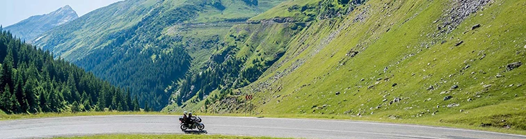
(40 miles/64.4 km) From the summit, take care and have fun on the tight hairpin curves that descend into the valley of Lake Creek, a dramatic, rugged alpine landscape. The highway then travels through the town of Twin Lakes, named for two naturally formed glacial lakes. Nearby Mt. Elbert is the highest peak in the state at 14,433 (4,399-m) feet above sea level. Further down the road is Hayden Ranch, founded in 1859, now a historic preservation site. The hay ranch once provided feed for horses serving Leadville’s mining industry. At the junction with U.S. Highway 24 follow the signs to Leadville, Colorado.

Leadville to Minturn

(30 miles/48.2km) During its heyday, Leadville was one of America’s richest and rowdiest mining boomtowns. The historic town is a Colorado treasure; seventy square blocks of the downtown have been designated a National Historic Landmark District of Victorian architecture. Top sites include the Delaware Hotel and the Tabor Opera House. Leaving Leadville via Tennessee Pass, make a stop at Camp Hale, home of the 10th Mountain Division. The WWII soldiers who trained here were part of an elite group specially trained in winter warfare.

Minturn to Glenwood Springs

(60 miles/96.5 km) The next big attraction on the way back to Glenwood Springs is one you’ll drive over. To appreciate the beauty of the Steel Arched Bridge near Red Cliff, Colorado, stop at one of the overlooks for a good view and a photo. From here, just enjoy the ride as the road curves around the mountain before making a steep descent into Minturn. From here, merge onto Interstate-70 for the final leg of the trip through Glenwood Canyon. The 12.5-mile-long canyon (20 km) is home to four rest and recreation areas, including Hanging Lake. The Colorado River gets credit for creating this geological wonder; highway engineers get high marks for their award-winning design that is still considered a marvel of modern engineering.

Other Itineraries

girl skiing at Sunlight

3×1: Three Glenwood Springs Winter Adventures in One Day

Vegan’s Guide to Eating Well in Glenwood Springs

Hot Springs Haven: A 36-Hour Geothermal Itinerary in Glenwood Springs

Paws-itive Vacation: A Pet-Friendly Glenwood Springs Itinerary

Rainy day view from the Glenwood Gondola

Rainy Day Itinerary: There’s No Singing The Blues in Glenwood Springs

VISIT GLENWOOD SPRINGS

802 Grand Avenue
Glenwood Springs, CO 81601
970-945-6580
info@visitglenwood.com

  • City of Glenwood Springs
  • Glenwood Springs Chamber Resort Association
  • Groups & Weddings
  • Media
  • Contact
  • City of Glenwood Springs
  • Glenwood Springs Chamber Resort Association
  • Groups & Weddings
  • Media
  • Contact
bell iconANNOUNCEMENTS
en English
en English es Spanish de German ru Russian ja Japanese ja French it Italian nl Dutch pt Portuguese zh-CN Chinese ko Korean ar Arabic
Download Travel Guide
Request Travel Guide
Download City Map
Join Our Mailing List
Visit the USA logo
Destination Verified logo
© 2026 Visit Glenwood Springs. All rights reserved |  (opens in a new tab)BlizzardPress | Privacy Policy | Accessibility